


GeoTools for Windows 7 - "Transform your maps: GeoTools" - Windows 7 Download

GeoTools 32.0
Discover the ultimate tool for managing geographic data. Boost your productivity with GeoTools.
GeoTools is a powerful software developed by the industry-leading team at GeoTools to provide Windows 7 users with a comprehensive set of geospatial analysis and visualization tools. This software is essential for professionals and students alike who need to manipulate, analyze and display geospatial data in an efficient and visually compelling way. With GeoTools, you'll be able to work more productively and achieve better results in no time. Download now and experience the difference that GeoTools can make in your geospatial workflow!
GeoTools 32.0 full details

| File Size: | 93.30 MB |
|---|---|
| License: | Open Source |
| Price: | FREE |
| Released: | 2024-09-27 |
| Downloads: | Total: 296 | This Month: 117 |
| Publisher: | GeoTools |
| Publisher URL: | http://geotools.org/ |

Download GeoTools 32.0
Save GeoTools to My Stuff
Tweet
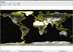
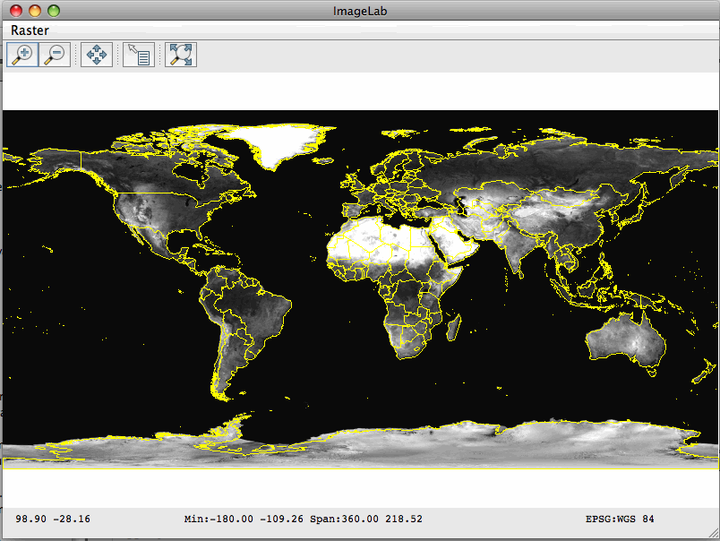
GeoTools 32.0 full screenshots
GeoTools - Windows 7 Download awards

GeoTools 32.0 full description
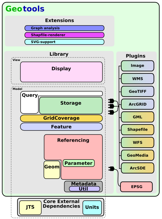
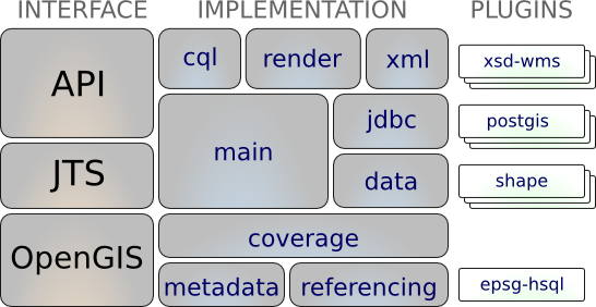
GeoTools is a library based on the specifications of Open Geospatial Consortium (OGC) that provides standard methods for working with geospatial data. It is used by web services, command line tools and several desktop programs. GeoTools is a flexible library of geospatial tools that can be extended through the implementation of additional modules. It works to both vector and raster data. It is widely used both in online services as well as in desktop applications and other tools.
GeoTools is an open source (LGPL) Java code library which provides standards compliant methods for the manipulation of geospatial data, for example to implement Geographic Information Systems (GIS). The GeoTools library implements Open Geospatial Consortium (OGC) specifications as they are developed.
FEATURES
OGC Standards Support WMS, WFS, GML, KML
Spatial Database Support DB2, Oracle Spatial, PostgreSQL/PostGIS, SQLServer
Referencing using ESPG Database
Raster and Vector support GeoTiff, SHP, World+Image
Rendering engine configured with OGC Standard Style Layer Descriptor
GeoTools 32.0 download tags
GeoTools 32.0 Windows 7 release notes
New Release
Bug:
GEOT-7127 Error in read empty DBF
GEOT-7528 GeoPackage: Timestamp is not written correctly
GEOT-7537 GeoPackage TIMESTAMP must be DATETIME according to the GeoPackage spec
GEOT-7539 The latest tutorials link is broken in https://docs.geotools.org/
GEOT-7540 startIndex parameter is not passed in WFS store request
GEOT-7569 throw error while adding feature to FlatGeobuf featureStore
GEOT-7579 FlatGeobuf handle java.util.Date and iso correctness
GEOT-7589 Fix the JsonArrayDelegation for Postgres to support searching in root level array
GEOT-7590 Patterns containing "&" are broken when using LikeFilter
GEOT-7596 Reduce change of white line artifacts when performing high subsampling on read
GEOT-7611 WMS Client throws an ArrayIndexOutOfBoundsException when parsing attribution logoUrl element in invalid capabilities XML
GEOT-7626 ReferencedEnvelope CRS compatibility check is not recognizing equivalent ProjectedCRS. (identity transformation between source and target CRS)
GEOT-7642 some modules rely on transitive version of units-api
Improvement:
GEOT-7422 Update java units "indriya" to version 2.2
GEOT-7546 Add AUTO code (97004) for Geostationary satellite projection
GEOT-7548 Renovate arcgisrest with dependency updates and code formatting
GEOT-7550 Try harder to reproject envelopes with projections having a complex valid area
GEOT-7557 Provide the ability for downstream applications (e.g. GeoServer) to append additional querystring parameters e.g. AuthKey to every request made by the HTTPClient
GEOT-7558 GeoPackage extension output contains field types that are not supported by GDAL
GEOT-7561 Proposal: Individual contributor clarification
GEOT-7565 Upgrade ImageIO-Ext to 1.4.10
GEOT-7571 Support updates for PostgreSQL json/jsonb columns
GEOT-7576 Make SchemaCache use the HttpClient from the GeoTools hints
GEOT-7586 GeoPackage output contains invalid field types when publishing content from other JDBCDataStore
GEOT-7614 support for postgres reWrite
[ GeoTools release history ]
Bookmark GeoTools
GeoTools for Windows 7 - Copyright information
All GeoTools reviews, submitted ratings and written comments become the sole property of Windows 7 download. You acknowledge that you, not windows7download, are responsible for the contents of your submission. However, windows7download reserves the right to remove or refuse to post any submission for any reason.
Windows 7 Download periodically updates pricing and software information of GeoTools full version from the publisher, but some information may be out-of-date. You should confirm all information.
Using warez version, crack, warez passwords, patches, serial numbers, registration codes, key generator, pirate key, keymaker or keygen for GeoTools license key is illegal and prevent future development of GeoTools. Download links are directly from our mirrors or publisher's website, GeoTools torrent or shared files from free file sharing and free upload services, including Rapidshare, MegaUpload, YouSendIt, SendSpace, DepositFiles, DivShare, HellShare, HotFile, FileServe or MediaFire, are not used.
Post GeoTools review


Windows 7 GeoTools related downloads
... Introducing SoftMeter, the powerful tool developed by StarMessage Software. SoftMeter provides software usage statistics for Windows 7, ...
... for Windows 7 users seeking the finest OCR software! Developed by the highly acclaimed "Best OCR Software ...
GeoDLL supports the development of geodetic software on various platforms by providing geodetic functions. GeoDLL
... developer will have an easier time creating the software applications! Xtreme Calendar Xtreme Calendar provides Windows ...
As a professional in software reviews, I present to you PySAL, the latest Windows 7 software developed by Sergio Rey. PySAL is a user-friendly ...
My Account
Help
Windows 7 Software Coupons
-
WinX MediaTrans
63% Off -
MacX Video Converter Pro
56% Off -
MacX MediaTrans
63% Off -
MacX DVD Video Converter
58% Off -
FREE VPN PROXY by SEED4.ME WINDOWS
Free VPN by Seed4Me
My Saved Stuff
You have not saved any software.
Click "Save" next to each software.
Click "Save" next to each software.
Would you like to receive announcements of new versions of your software by email or by RSS reader? Register for FREE!
Windows 7 Downloads Picks
- dotConnect for MySQL Professional 10.1.35
- dotConnect for Oracle Professional Edition 11.1.33
- Audio DJ Studio for .NET 11.0
- Audio Sound Editor for .NET 8.0
- PDF-XChange Drivers API 10.1.1.381
- SmartCode VNC Manager Standard Edition x64 2023.9.1
- Python Encryption Library x64 9.5.0.98
- Audio Capture Pro ActiveX Control 2.0
- SmartCode VNC Manager Enterprise Edition x64 2023.9.1
- dotConnect Universal Mobile Edition 5.2.21
- Data Burner ActiveX Ocx SDK 4.1
- THTMLPopup 10.2.4.0
- VideoCap Pro SDK ActiveX 17.0.0.0
- Visualization Toolkit (VTK) 9.1.0
- MailMill COM x64 1.2.5
- My RSE Extensions 1.0.2
- TsMultiLineComboBox 1.04
- Ultimate SFTP Component 5.2.9092
- JOpt.NET 2.3.6
- GTK+ for Windows x64 3.24.14
Popular Tags
.net
windows 7
server
activex
dll
dotnet
pdf
pdf417
barcode
net
postnet
component
smtp
mime
delphi
sdk
windows
vb net
pop3
visual studio
html
net component
visual basic
control
programming
email
library
code 93
asp net
ssl
Popular Windows 7 Software
- Simply Fortran 3.41 Build 4438
- PHP 8.5.5
- dotConnect for MySQL Professional 10.1.35
- dotConnect for Oracle Professional Edition 11.1.33
- Miraplacid Text Driver SDK 8.0
- Turbo C++ 3.0
- dbForge Documenter for SQL Server 2025.3
- Windows Installer 4.5
- StyleControls 5.86
- Software Ideas Modeler Portable 15.31
- Free OCR C# 2022.8.7804
- Windows Post-Install 8.7.2
- Review Assistant 4.3.11
- Java SE Development Kit (JDK) 8 Update 221
- Code::Blocks for Windows 20.03 Build Apr 3 20
© 2026 Windows7Download.com - All logos, trademarks, art and other creative works are and remain copyright and property of their respective owners. Microsoft Windows is a registered trademarks of Microsoft Corporation. Microsoft Corporation in no way endorses or is affiliated with windows7download.com.