


Mobile Atlas Creator for Windows 7 - Create maps for mobile. - Windows 7 Download

Mobile Atlas Creator 2.2.1
"Transform your travels with Mobile Atlas Creator - the ultimate mapping software."
Introducing Mobile Atlas Creator, the ultimate map creator for Windows 7 users! Developed by Fredrik Moller, this software allows you to customize and create maps for your mobile devices. With its user-friendly interface, you can easily choose a map source and adjust its parameters. Make your travels easier by having your personalized maps on-the-go. Download Mobile Atlas Creator now and start exploring the world, your way!
Mobile Atlas Creator 2.2.1 full details

| File Size: | 15.00 MB |
|---|---|
| License: | Freeware |
| Price: | FREE |
| Released: | 2021-06-02 |
| Downloads: | Total: 2882 | This Month: 226 |
| Publisher: | Fredrik Moller |
| Publisher URL: | https://mobac.sourceforge.io/ |

Download Mobile Atlas Creator 2.2.1
Save Mobile Atlas Creator to My Stuff
Tweet
Mobile Atlas Creator 2.2.1 full screenshots
Mobile Atlas Creator - Windows 7 Download awards


Mobile Atlas Creator 2.2.1 full description
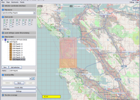
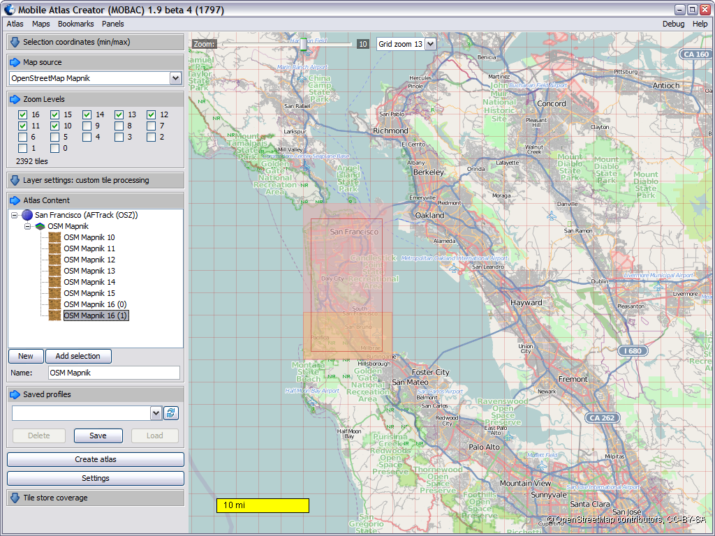
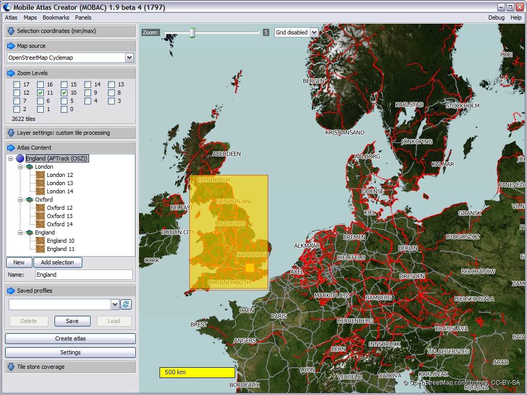
Mobile Atlas Creator (formerly known as TrekBuddy Atlas Creator) is an open source (GPL) program which creates offline atlases for GPS handhelds and cell phone applications like TrekBuddy, AndNav and other Android and WindowsCE based applications.
For the full list of supported applications please see the features section. Additionally individual maps can be exported as one large PNG image with calibration MAP file for OziExplorer. As source for an offline atlas Mobile Atlas Creator can use a large number of different online maps such as OpenStreetMap, Google Maps, Yahoo Maps and other online map providers.
Features:
Create offline atlases for a large number of different (mobile) applications and GPS handhelds:
AFTrack (Symbian)
AlpineQuest (Android)
AndNav (Android)
BackCountry Navigator (Android)
Big Planet Tracks SQLite format (Android)
CacheBox (Windows Mobile)
Cachewolf
Garmin Custom Map - KMZ (GPS handhelds)
Glopus (Pocket PC)
Google Earth
GPS Sport Tracker
Magellan RMP (GPS handhelds) & VantagePoint
Maplorer (Windows CE/Windows Mobile)
Maverick (Android)
Mobile Trail Explorer (J2ME) - single tiles and MTECache file
NaviComputer (Windows Mobile)
nfComPass (WinCE, WinMobile, WinXP)
OruxMaps (Android)
OsmAnd
Osmdroid (Android)
OSMtracker (Windows Mobile/Pocket PC)
OziExplorer (single 24bit PNG image with calibration (MAP) file
PathAway (Windows Mobile)
RMaps SQLite (Android)
[Nokia] Sports Tracker
Touratech QV (Windows software, commercial)
TrekBuddy (J2ME, Android)
u-blox
and others
Prepare atlases consisting of multiple layers, different map sources map resolutions (zoom levels)...
Save and load your favorite atlas compilation as profile to/from file
Merge different layers using Drag & Drop
Create map tiles using custom size and image format (PNG/JPG)
Fast download of map tiles using simultaneous multithreaded download (number of threads configurable)
Downloaded tiles are cached locally - avoids multiple downloads of same map tiles
Download only updated tiles - use locally cached tiles otherwise
Full support for network connections via HTTP proxy
Mobile Atlas Creator 2.2.1 download tags
Mobile Atlas Creator 2.2.1 Windows 7 requirements
Java 8 or higher
Bookmark Mobile Atlas Creator
Mobile Atlas Creator for Windows 7 - Copyright information
All Mobile Atlas Creator reviews, submitted ratings and written comments become the sole property of Windows 7 download. You acknowledge that you, not windows7download, are responsible for the contents of your submission. However, windows7download reserves the right to remove or refuse to post any submission for any reason.
Windows 7 Download periodically updates pricing and software information of Mobile Atlas Creator full version from the publisher, but some information may be out-of-date. You should confirm all information.
Using warez version, crack, warez passwords, patches, serial numbers, registration codes, key generator, pirate key, keymaker or keygen for Mobile Atlas Creator license key is illegal and prevent future development of Mobile Atlas Creator. Download links are directly from our mirrors or publisher's website, Mobile Atlas Creator torrent or shared files from free file sharing and free upload services, including Rapidshare, MegaUpload, YouSendIt, SendSpace, DepositFiles, DivShare, HellShare, HotFile, FileServe or MediaFire, are not used.
Post Mobile Atlas Creator review


Windows 7 Mobile Atlas Creator related downloads
GPS Utility is an easy-to-use application that provides management and manipulation of GPS information. You can use it to transfer data ...
Engauge Digitizer - Digitizing software This open source, digitizing software converts an image file showing a graph or ...
... The FreeGIS Project provides an overview of Free Software GIS projects. Many valuable and highly sophisticated tools ...
... command-line driven graphing utility for linux, OS/2, MS Windows, OSX, VMS, and many other platforms. The source ...
... algorithms. VTP writes and supports a set of software tools, including an interactive runtime environment (VTP Enviro). ...
My Account
Help
Windows 7 Software Coupons
-
WinX MediaTrans
63% Off -
FREE VPN PROXY by SEED4.ME WINDOWS
Free VPN by Seed4Me -
MacX DVD Ripper Pro
50% Off -
WinX DVD Ripper
50% Off -
MacX Video Converter Pro
56% Off
My Saved Stuff
You have not saved any software.
Click "Save" next to each software.
Click "Save" next to each software.
Would you like to receive announcements of new versions of your software by email or by RSS reader? Register for FREE!
Windows 7 Downloads Picks
- LochMaster 4.0
- BricsCad Classic 24.2.06-1
- Sweet Home 3D 7.4
- Mobile Atlas Creator 2.2.1
- MVSP 3.22
- MaxIm DL 6.05
- Graph Streaming 0.7.0.12
- GPS Utility 5.51
- Melanie Viewer 7.0.7
- Geneious PRO x64 6.0.4
- Jmol 14.31.53
- Sprint-Layout 6.0
- DICOMscope 3.5.1
- Geneious PRO for Vista 4.7.6
- LabCollector 4.96
- EAGLE Light 9.6.2
- Geneious PRO 6.0.4
- CurveExpert Professional 2.7.3
- Circuit Diagram 3.1.0 B3
- Graph construction program 3.2.0
Popular Tags
import
solidworks
viewer
hpgl
open
software
solidedge
home
cam
bmp
cad
intellicad
assembly
design
dwg
file
converter
plug in
dxf
convert
landscape
obj file
stl
export
architect
autocad
view
stl file
animation
dwg viewer
Popular Windows 7 Software
- CorelDRAW X7 (x32 bit) 17.4.0.887
- CorelDRAW X7 (x64 bit) 17.4.0.887
- CorelDRAW X5 15.2.0.686
- CorelDRAW X4
- iTop Screenshot 1.2.3.544
- CorelDRAW 2017 19.1.0.419
- CorelDRAW X6 16.4.0.1280
- Blender - 32 bit 2.80
- Adobe InDesign CS5 CS5.5 7.5.3
- CorelDRAW X8 18.0.0.450
- Graphic Workshop Professional 15.0a rev11
- Model Air Design 2.4
- Blender Portable 4.1.1
- Model Air Design 2.4
- Paint.NET 5.0.13
© 2026 Windows7Download.com - All logos, trademarks, art and other creative works are and remain copyright and property of their respective owners. Microsoft Windows is a registered trademarks of Microsoft Corporation. Microsoft Corporation in no way endorses or is affiliated with windows7download.com.