


Global Mapper for Windows 7 - "Revolutionize GIS with Global Mapper." - Windows 7 Download

Global Mapper 25.1
Discover the ultimate mapping software for Windows 7. Download Global Mapper today.
Welcome to the page for "Global Mapper," the ultimate tool for mapping and geographic analysis. Developed by Blue Marble Geographics, this cutting-edge software has everything you need to create detailed maps and conduct spatial analysis, all with a user-friendly interface. With seamless integration with popular GIS systems and a wide range of data formats supported, "Global Mapper" is the perfect choice for professionals in industries from mineral exploration to environmental management. Download "Global Mapper" today and unlock the potential of your data.
Global Mapper 25.1 full details

| File Size: | 184.00 MB |
|---|---|
| License: | Demo |
| Price: | $499.00 |
| Released: | 2024-02-15 |
| Downloads: | Total: 6107 | This Month: 144 |
| Publisher: | Blue Marble Geographics |
| Publisher URL: | https://www.bluemarblegeo.com/ |

Download Global Mapper 25.1
Save Global Mapper to My Stuff
Tweet
Global Mapper - Windows 7 Download awards


Global Mapper 25.1 full description
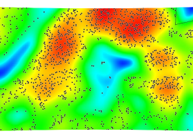
Global Mapper is more than just a utility; it has built in functionality for distance and area calculations, raster blending, feathering, spectral analysis and contrast adjustment, elevation querying, line of sight calculations, cut-and-fill volume calculations, as well as advanced capabilities like image rectification, contour generation from surface data, view shed analysis (including Fresnel) from surface data, watershed delineation, terrain layer comparison (including differencing), and triangulation and gridding of 3D point data. Repetitive tasks can be accomplished using the built in scripting language or comprehensive batch conversion functionality.
Have you ever received a dataset that does not match the projection of your current project? Simply load the dataset into Global Mapper, change the projection, and save the file to match your coordinate system. If the dataset is larger than the area you are interested in, export the data using the crop feature and change the projection and format of the data at the same time.
Your data files can be loaded as layers, for example a Digital Elevation Model (DEM) can be loaded with a scanned topographical map to create a 3D view of the map. A digital aerial image can be draped on the surface together with vector contour mapping to create a stunning and informative graphic. The results can be printed, or the workspace can be exported to a high resolution raster image for use in a presentation or report.
FEATURES:
Provides direct access to DigitalGlobe high resolution color imagery and OpenStreetMap.org detailed street maps for the entire world from within the application!
Provides direct access to the complete TerraServer-USA satellite imagery and topographic map archive for the entire US free-of-charge within the application!
Provides easy, direct access to WMS data sources, including built-in access to the complete 30-m NED database, the 3-arc second world SRTM database, and color global Landsat imagery free-of-charge within the application!
Supports true 3D viewing of loaded elevation and 3D vector data including draping of any loaded imagery and vector data over the 3D surface.
Crop, reproject, and merge/mosaic any combination of raster data and elevation data, including DRGs. You can also crop data to an area feature. Data will automatically mosaic into the correct location relative to each other using positioning information associated with the data.
GeoPDF® SUPPORT! You can import GeoPDF® files and export any collection of loaded data to new Geo-enabled PDF files, making your data accessible to any user without requiring them to have any mapping knowledge.
DIGITIZING SUPPORT! You can digitize new vector (area, line, and point) features by drawing them with the mouse. You can also edit existing vector features. Newly created and editing features can be saved to any of the supported export formats. In addition, shapes like rectangles, circles, ellipses, arcs, buffers around existing features, and concentric range rings can be easily created as well. You can also input features via a series of distance/bearing/COGO coordinates.
Global Mapper 25.1 download tags
Bookmark Global Mapper
Global Mapper for Windows 7 - Copyright information
All Global Mapper reviews, submitted ratings and written comments become the sole property of Windows 7 download. You acknowledge that you, not windows7download, are responsible for the contents of your submission. However, windows7download reserves the right to remove or refuse to post any submission for any reason.
Windows 7 Download periodically updates pricing and software information of Global Mapper full version from the publisher, but some information may be out-of-date. You should confirm all information.
Using warez version, crack, warez passwords, patches, serial numbers, registration codes, key generator, pirate key, keymaker or keygen for Global Mapper license key is illegal and prevent future development of Global Mapper. Download links are directly from our mirrors or publisher's website, Global Mapper torrent or shared files from free file sharing and free upload services, including Rapidshare, MegaUpload, YouSendIt, SendSpace, DepositFiles, DivShare, HellShare, HotFile, FileServe or MediaFire, are not used.
Global Mapper users' reviews
Global Mapper 19.1 b021218
review by garci (Apr 7, 2018)

THIS LOGICIAL helpes me in my studies geographics
Post Global Mapper review


Windows 7 Global Mapper related downloads
Global Mapper is more than just a utility; it has ... your current project? Simply load the dataset into Global Mapper, change the projection, and save the file ...
My Account
Help
Windows 7 Software Coupons
-
MacX Media Management Bundle
70% Off -
MacX MediaTrans
63% Off -
MacX DVD Video Converter
58% Off -
MacX DVD Ripper Pro
50% Off -
WinX DVD Copy Pro
42% Off
My Saved Stuff
You have not saved any software.
Click "Save" next to each software.
Click "Save" next to each software.
Would you like to receive announcements of new versions of your software by email or by RSS reader? Register for FREE!
Windows 7 Downloads Picks
- GeoGebra Portable 6.0.920.0
- Minister Scheduler Pro 5.2.2 B4
- Jutoh 3.29.4
- Portable SMath Studio 0.95 B4594
- SkyGazer 4.5.7
- QuranReciter 4.1
- Global Mapper x64 25.1
- MathType 7.4.8
- UniConv 2.02
- Workrave Portable 1.10.52
- EarMaster School 5.0 Build 6
- Diamond Scheduler 6.96 B4058
- Portable Brain Workshop 4.8.4
- OpenGLM 1.2.158
- MartView 2.5.4
- Portable Marble 2.2.0
- SMath Studio 1.0.8763
- My Music Tutor 1.1.0.2
- jVLT 1.3.3
- KidLogger Pro 8.6
Popular Tags
vocabulary
tuner
math
viewer
solve equation
ipad pdf transfer
music
e book
create
equation
chinese
learn
chords
exam
metronome
course
medical template
guitar
literature
medical office notes
quiz
manager
organizer
education
ebook
software
fables
classics
creator
user-friendly
Popular Windows 7 Software
- Punjabi Typing Master 4.0.0
- Windows 7 for Beginners
- GeoGebra Portable 6.0.920.0
- PowerAFA Aphasia Treatment Software 7.1.6
- Minister Scheduler Pro 5.2.2 B4
- Borno - A FREE Bangla Typing Software 2025.1.13
- Design Master 8.0.11
- Language Reader 2.01
- Jutoh 3.29.4
- Portable SMath Studio 0.95 B4594
- Hindi Typing Tutor
- SkyGazer 4.5.7
- TypingMaster 11 Typing Tutor 11.00
- QuranReciter 4.1
- RDIT 1.0
© 2026 Windows7Download.com - All logos, trademarks, art and other creative works are and remain copyright and property of their respective owners. Microsoft Windows is a registered trademarks of Microsoft Corporation. Microsoft Corporation in no way endorses or is affiliated with windows7download.com.